
Большой трансграничный маршрут – военное наследие за 100 лет Латвии и Эстонии
Музей Pождественских боев и выставка под открытым небом
Мемориальный парк и музей Рождественских боев находится в Валгундской волости Елгавского края, в домах «Мангали». Музей является филиалом Латвийского военного музея, он был открыт в 2005 году и находится на территории, где проходили Рождественские бои. В местах сражений до сих пор сохранились уникальные укрепления времен Первой мировой войны. В экспозиции музея представлены предметы, найденные на полях сражений.
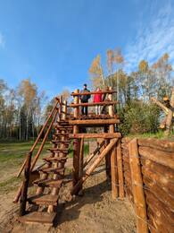
Восстановленные укрепления можно увидеть в рамках экспозиции под открытым небом. Рядом с музеем проложены туристические маршруты и образовательные тропы. Экспозиция фортификаций и выставок времен Первой мировой войны под открытым небом открыта для посетителей каждый день. В окрестностях Ложметейкалнса сохранились уникальные свидетельства укреплений времен Первой мировой войны. Здесь находится смотровая башня высотой 27 м, с которой открывается панорамный вид на места Рождественских боев. Рождественские бои, пожалуй, самое известное и драматичное событие Первой мировой войны в Латвии. Оно занимает особое место в военной и культурной истории Латвии. Бои в основном связаны с нападением латышских стрелков на части немецкой армии, которое проходило в особо тяжелых и неблагоприятных условиях. Небывалый случай, чтобы крупномасштабная боевая операция начиналась без артиллерийской поддержки.
Лестенская лютеранская церковь
Расположен в Тукумском районе, в Лестене, рядом с церковью.
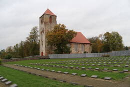
Создание братской могилы в Лестене началось в 1998 году. Это второе по величине военное кладбище в Латвии, где похоронены более 1300 латышских легионеров. Только после восстановления Латвийской Республики стало возможным перезахоронить латышских солдат, павших во Второй мировой войне, из разных мест.
Латышский легион был боевым подразделением немецкой армии, сформированным преимущественно из нелегально мобилизованных жителей Латвии. Солдаты воспринимали своё пребывание в легионе как борьбу за восстановление независимости Латвии, несмотря на то, что она проходила в рядах немецких вооружённых сил, а Германия оккупировала Латвию. Никакая другая военная сила не могла бы задержать возвращение советской оккупации. Латышские легионеры сражались против Красной Армии, которая ликвидировала независимость Латвии, уничтожила её армию и совершила преступления против мирного населения. В рядах немецкой армии сражалось около 110 000–115 000 солдат, из которых около 30 000–50 000 погибли на полях сражений.
В наши дни в Лестене можно посетить Братскую могилу, рядом с которой находится Лестенская церковь – выдающийся образец сакрального искусства эпохи барокко. В старинном церковном корчме можно ознакомиться с экспозицией, посвящённой истории Латышского легиона. Центральный образ братской могилы – «Родина – Мать – Латвия» – создала скульптор Арта Думпе. Неподалёку находится Лестенская усадьба, которая до Второй мировой войны принадлежала генералу Латвийской армии Мартиньшу Хартманису.
Экскурсию по церкви Лестене можно заказать у настоятеля евангелическо-лютеранской церкви Лестене Ингуны Кокиной по телефону +371 29993743.
Музей национального движения сопротивления в Ренде
Музей расположен в нескольких километрах от центра Ренды. Выставка рассказывает о движении сопротивления в Латвии, которое длилось 50 лет: сопротивление первой советской оккупации, сопротивление оккупации нацистской Германии, вооруженное и ненасильственное сопротивление советской оккупации. Экспозиция расположена в двух зданиях. В первом здании можно осмотреть свидетельства первой советской оккупации и немецкой оккупации. В отреставрированном здании амбара экспозиция посвящена национальной партизанской войне. Между двумя зданиями находится бункер с аутентичной планировкой и траншеями, по которым перемещались солдаты. Рядом с музеем в Ренде находятся траншеи, блиндажи и полоса препятствий как тренировочная площадка для Яунсардзе и других желающих. Посещение необходимо бронировать заранее.
Рядом с этим местом в январе 1946 года произошло одно из крупнейших сражений национальных партизан, получившее название битва при Апузниеки, в котором группа национальных партизан Кабиле одержала победу над существенно превосходящими её оккупационными войсками. На месте боя оборудована зона отдыха и установлены информационные стенды.
Коллекция автомобилей советской армии
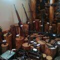
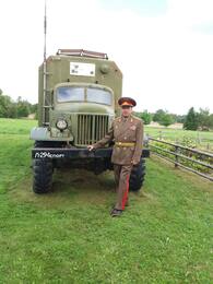
Владелец гостевого дома «Pūpoli» Эдгарс Карклевалкс в Дундагском крае уже более 15 лет предлагает отправиться в историческую ознакомительную поездку по северу Курземе на собственноручно отремонтированном грузовике Советской Армии ГАЗ-66 (до 24 человек) и УАЗ-3151 (до 6 человек). Маршрут включает бывшие военные объекты. На территории гостевого дома можно осмотреть автомобили советской армии и другую технику.
Маяк Овиши и береговая погранохрана
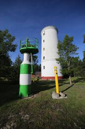
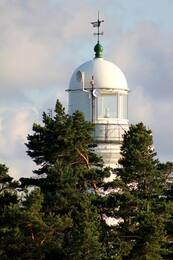
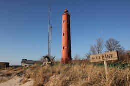
Маяк Овиши находится в Таргальской волости, Овиши, на Курземском побережье и является старейшим маяком в Латвии - он был построен в 1814 году. Высота башни маяка Овиши составляет 37 метров. Маяк имеет двухцилиндровую конструкцию: его диаметр составляет 11,5 м, а внутри каменной стены находится вторая башня диаметром 3,5 м. Двухцилиндровый маяк такого типа в 18-19 веках в Европе использовался, в том числе в качестве оборонительного сооружения на случай нападения врага. Музей маяка Овиши обладает самой богатой коллекцией маякового оборудования и предметов морской навигации среди всех маяков-музеев Латвии. В ясную погоду с маяка Овиши можно увидеть маяк Ирбе.
В конце Второй мировой войны в районе маяка Овиши располагался штаб батальона Бемингера немецкой армии и 4-я батарея 530-й морской артиллерийской дивизии с несколькими зенитными орудиями. Вероятно, у подножия маяка находился радиомаяк и инфракрасный приемник (Donau Gerät). Когда-то возле маяка располагался советский пограничный пост, но до наших дней постройки советских времен не сохранились. Здание вокзала Овиши до сих пор находится на территории маяка.
Башня коррекции наводки огня 46-й береговой батареи Вентспилса
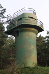
Отреставрированная Башня коррекции наводки огня 46-й береговой батареи Вентспилса находится на улице Саулриета и доступна для посетителей как смотровая вышка. Эта башня с прилегающими позициями для четырех пушек - единственная батарея береговой обороны в Латвии, которая сохранилась в таком хорошем состоянии со времен Второй мировой войны. По лестнице в башне посетители могут подняться на открытую смотровую площадку, с которой открывается вид на море. Рядом с башней установлен информационный стенд, дополненный QR-кодом, с помощью которого можно посмотреть анимацию об исторических событиях. Рядом с башней обустроена новая улица, большая автостоянка и деревянный мостик над зоной природного заповедника.
Этот военный комплекс был построен в 1939 году, когда началось строительство военных баз СССР в Латвии. 46-я батарея береговой охраны насчитывала четыре позиции для пушек типа Б-13. Первый бой эта батарея приняла 24 июня 1941 года, когда немецкий торпедный катер атаковал порт Вентспилс и был отброшен ответным огнем батареи с берегов Балтийского моря. 28 июня Советская армия взорвала пушки.
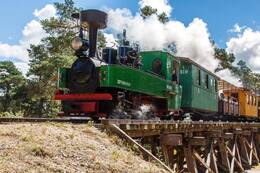
Паровоз узкоколейной железной дороги «Mazbānītis» в вентспилсском приморском музее под открытым небом
В Приморском музее под открытым небом в Вентспилсе предлагаются поездки по двум железнодорожным линиям узкоколейной железной дороге или «Mazbānītis»: по кольцевой линии - 1,4 км и по горной линии - 3,0 км. «Mazbānītis» — это поезд, который с 1916 по 1963 год перевозил пассажиров и грузы по узкоколейным железнодорожным путям шириной 600 мм. Это наследие военной истории времен Первой мировой войны, которое когда-то играло важную роль в процветании культуры и экономики севера Курземе, обеспечивая связь между поселениями и рабочие места.
Строительство железной дороги шириной 600 мм было связано с Первой мировой войной, когда немецкая армия прибегла к строительству нескольких так называемых железных дорог «поля боя» (нем. Heeresfeldbahn) на оккупированной территории Латвии в 1916 году. Эти железные дороги можно было быстро построить, снести и перенести на другую линию фронта. Узкоколейные железные дороги Латвии продолжали непрерывно работать и в годы Второй мировой войны. На протяжении почти 60 лет узкоколейные железные дороги были единственным безопасным средством перевозки пассажиров, различной сельскохозяйственной продукции и лесоматериалов в города, как зимой, так и летом.
Смотровая вышка Советской пограничной службы - смотровая башня в Павилосте
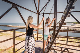
Советская пограничная смотровая башня находится на Южном пирсе в Павилосте. Бывшая советская пограничная смотровая башня, которая не использовалась с начала 1990-х годов, теперь превратилась в смотровую площадку с вращающимся на 360 градусов наземным телескопом. Отсюда открывается прекрасный вид на море и корабли, можно также понаблюдать за птицами. Подниматься на башню разрешено только в светлое время суток в летний сезон. Поскольку лестница в башне достаточно крутая, посетителям необходимо оценивать свои способности, состояние здоровья и соответствующие риски. На смотровой башне и на прилегающей территории ведется видеонаблюдение. Зимой башня закрыта для посетителей.
Постоянная экспозиция Павилостского краеведческого музея
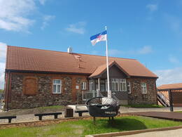
В Павилостском краеведческом музее можно осмотреть выставку «Павилоста - закрытая зона» о жизни Павилосты в годы советской оккупации - исполнительной власти, приграничной зоне, рыбном колхозе, культурной и повседневной жизни. В дополнение к постоянной экспозиции была представлена интерактивная эмоционально насыщенная цифровая выставка на двух языках и аудиовизуальная инсталляция, где можно посмотреть фильм о Павилосте.
В музее создана новая выставка «Золотые песчинки Павилосты». Цифровая выставка позволяет увидеть события прошлого, развитие Павилосты и самые важные события с 1918 года до наших дней. О военном наследии рассказывает раздел освободительной войны о борцах за свободу Латвии и временах советской оккупации
Маяк Акмеенрагс и судьба "Саратова"
Маяк Акменьрагс находится в Сакской волости, в 10 км к юго-западу от Павилосты. На маяк можно подняться по винтовой лестнице, и с него открывается вид на море и окрестные леса. Нынешняя башня маяка высотой 37 м была построена в 1921 году, а предыдущий маяк был разрушен во время Первой мировой войны.
Среди других маяков Латвии маяк Акменьрагс выделяется своим расположением в одном из самых опасных для судоходства мест на всем побережье Балтийского моря. Свет маяка указывает на каменистую отмель длиной около двух морских миль или 3,7 км, достигающий моря в северо-западном направлении. Глубина моря на этой отмели составляет чуть более двух метров. Место, расположения маяка осталось прежним, но берег с годами отступил. Несмотря на то, что навигационный огонь здесь горел ещё с 1879 года, Акменьрагс пережил несколько кораблекрушений. Самое известное из них – посадка на мель латвийского парохода «Саратов» в сентябре 1923 года. В 1919 году Саратов ненадолго стал резиденцией Временного правительства Латвии. В Акменьрагсе располагался пост погранохраны, здесь можно осмотреть здания Советской армии.
Мемориал жертвам Холокоста в Лиепае
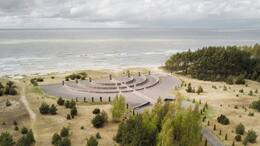
Самый большой памятник жертвам Холокоста в Латвии находится в Лиепае, в дюнах Шкеде. Мемориал посвящен памяти более 3000 лиепайских евреев, убитых во время Второй мировой войны. Он имеет форму национального символа Израиля, Меноры, то есть семирожкового светильника. Контуры мемориала, которые хорошо видно с высоты птичьего полета, сложены из битых валунов и гранитных блоков. «Светильники» Меноры сделаны из гранитных столбов с выдолбленными на них стихами из Плача Иеремии на иврите, английском, латышском и русском языках.
Лиепайский северный форт и батарея № 1 в Каросте
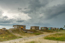
Северные форты - самая известная и визуально впечатляющая часть Лиепайской крепости. Их историческое название - Крепостная батарея № 1. Форты были построены русской царской армией в конце 19-го века.
Менее чем через 10 лет после постройки - в ноябре 1908 года - Лиепайскую крепость ликвидировали, так как ее строительство было признано стратегической ошибкой. Часть пушек разобрали и перевезли в Каунасскую крепость в Литве, часть переплавили. Здания крепости дважды взрывали, чтобы разрушить укрепление. До наших дней сохранились не взорванные до конца артиллерийские батареи и подземные сооружения. Северные форты, как и Кароста, в советское время были закрытой военной территорией. Будьте очень осторожны при посещении северных фортов. Крутой берег Балтийского моря в Каросте, как и в других местах на латвийском побережье, опасен, поскольку может обрушиться, поэтому ходить под развалинами фортов запрещено.
Кароста, военный порт Лиепаи (тур)
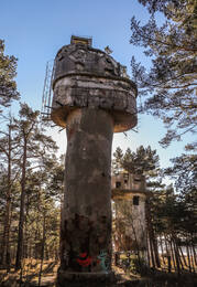
Кароста является крупнейшей исторической военной территорией в Балтии и занимает почти треть всей территории Лиепаи. Кароста - это уникальный комплекс военных и фортификационных построек на берегу Балтийского моря, который является особенным в истории и архитектуре Латвии и мира. В Каросте можно осмотреть такие объекты военного наследия, как Северный пирс и форты, Реданс, тюрьма Кароста, водонапорная башня Кароста, Свято-Никольский морской собор, мост О. Калпакса и другие.
Вагон-музей у станции Скрунда в память о депортации
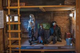
В память о депортациях июня 1941 и марта 1949 года у железнодорожной станции Скрунда установлены мемориальный камень и четырехосный вагон - музей памяти депортаций. Это первый вагон-музей в Латвии, в котором размещена постоянная экспозиция - фотографии, письма, воспоминания, документы и различные вещи, сделанные депортированными. Станция Скрунда была одной из трёх станций - пунктов сбора для людей, подлежавших депортации. Сюда привозили людей из Скрунды и окрестностей Кулдиги. В 1941 году отсюда в Сибирь, в Красноярский край, была депортирована семья первого президента Латвийской Республики после восстановления независимости Гунтиса Улманиса.
Усадьба Скрунда и экспозиция о радиолокационной станции «Скрунда»
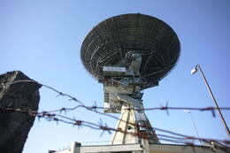
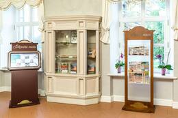
В усадьбе Скрунда создана экспозиция, посвященная локатору Скрунды или радиолокационной станции «Скрунда» и Латвийскому народногму фронту в Скрунде. Радиолокационная станция «Скрунда» под кодовым названием «Комбинат» была системой предупреждения о ракетном нападении СССР в западном секторе. Топоним «Скрунда-2» означал особый «городок» (в / ч 18951), когда-то созданный для нужд Вооруженных сил СССР, расположенный в 5 км от Скрунды в направлении Кулдиги. Здесь работала радиолокационная станция «Днепр» и строилась новая, более современная радарная установка «Дарьал». Строительство было остановлено, а 4 мая 1995 года установка «Дарьял» была взорвана. Согласно межгосударственному соглашению, радиолокационная станция «Днепр» была отключена 31 августа 1998 года.
Мемориальный музей Оскарса Калпакса «Айритес»
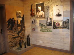
Музей Оскарса Калпакса «Айритес» расположен между Салдусом и Скрундой, недалеко от автомагистрали A9. В экспозиции представлена обширная информация о полковнике Оскарсе Калпаксе и его батальоне, показана история создания Латвийской национальной армии и мемориального комплекса «Айритес». Экспозиция музея раскрывает полковника Оскарса Калпакса как личность, как солдата и борца за независимость Латвии. Экспозиция дополнена записями воспоминаний в аудиоформате (на латышском, английском, немецком языках). Они выделяют важность исторических событий 1918/1919 гг. для защиты латвийской государственности. Здание музея отреставрировано. Вход свободный, экскурсия с гидом платная. Можно посетить зону отдыха, парк, полосу препятствий, различные занятия. Имеется зал для семинаров до 30 мест.
Наблюдательная вышка Советской Армии (Курган офицеров)
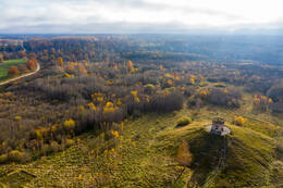
Офицерский курган" расположен менее чем в километре от руин Звардской церкви. Курган состоит из руин и остатков окружающих домов и усадьбы, которые были снесены бульдозером. На кургане была построена наблюдательная башня. Согласно надписи, нынешняя башня была построена в 1981 году. Вышка использовалась для регистрации попаданий бомб. Учебные бомбы имели пониженное содержание взрывчатого вещества, поэтому за их попаданиями приходилось следить более тщательно. Неразорвавшиеся бомбы сразу же обезвреживались, но не все их удавалось найти.
Остатки башни можно увидеть здесь и сегодня - кирпичные стены. Поскольку барраж находится относительно высоко, в ясный день можно увидеть даже литовский нефтеперерабатывающий завод в Мажейкяе.
Олайнский (Olaine) историко-художественный музей и образовательная тропа времен Первой мировой войны с землянкой
Экспозиция Олайнского историко-художественного музея рассказывает о периоде советской оккупации в Олайне. На территории музея проложена образовательная тропа времен Первой мировой войны, на которой восстановлены элементы укреплений. На месте оборонительной линии русской армии времен Первой мировой войны заново построена землянка русских солдат, виден фрагмент стрелковой башни. В Яунолайне, на повороте в Плаканциемс, находится железобетонное укрепление времен Первой мировой войны. Во время Первой мировой войны в этом районе происходили боевые действия между русской и немецкой армиями. Латышские стрелковые части участвовали в разведке и различных операциях. Болотистая местность сделала его трудным для обороны, но очень важным местом боев в истории Латвии. Олайне образовалось благодаря удобному расположению между Елгавой и Ригой, где в настоящее время находится Яунолайне. Оно находилось недалеко от усадьбы Олайне. В свою очередь, современное Олайне было построено во время советской оккупации, когда здесь начали развиваться промышленные предприятия.

Комплекс береговой обороны Мангальсала (Mangaļsala)
Прибрежные укрепления расположены в Риге, на Мангальсале, в устье Даугавы в море напротив Даугавгривы. Здесь вы можете увидеть укрепления, построенные разными армиями (русской, латвийской, немецкой и советской). Укрепления Мангальсалы предназначались для защиты города Риги от вражеского флота. Эта территория долгое время сохраняла свое стратегическое значение. После Первой мировой войны у латвийской армии еще не было сильного военного флота. Морская граница была длинной, и защита побережья стала затруднительной. Латвийская армия заполучила фортификационные сооружения, построенные Российской империей в конце 19-го - начале 20-го века, и расширила систему обороны. Артиллерия Даугавгривы и Мангальсалы должна была обстреливать вражеские корабли, пытающиеся прорваться в устье Даугавы, а опорные пункты в устьях Лиелупе (Юрмала) и Гауи (Царникава) должны бы остановить высадку противника. Для защиты побережья имелся один специально оборудованный бронепоезд, который обеспечивал артиллерийскую поддержку и дополнительные силы в направлении Саулкрасты или Юрмалы. Целью укрепления стратегических объектов было усиление эффективности оружия за счет специальных сооружений и рельефа местности. Укрепление береговой охраны было рассредоточено на большой территории, чтобы уменьшить влияние врага в случае войны.
Aудио гид https://izi.travel/en/edbf-ukrepleniya-mangalsala/ru
Советский военный городок в Межгарциемсе (Mežgarciems)
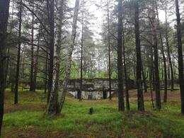
Бывший военный городок советской армии расположен в Межгарциемсе Адажского района, недалеко от автомагистрали Р1. Информационные стенды установлены недалеко от городка войск ПВО Советской армии, в котором когда-то находилась база для тренировочных целей. Посетители могут осмотреть территорию бывшей армейской базы. Межгарциемса не было на картах времен советской оккупации. Не было никаких свидетельств того, что там находился построенный для советских солдат военный городок с базой ПВО. После Второй мировой войны на территории Латвии происходило быстрое и масштабное строительство мест дислокации Советской армии. Базы чужой армии были подобны государству внутри государства. Военные части в Латвии были практически повсюду. Отставные военные СССР и их семьи, которых в первую очередь приходилось обеспечивать жильем, были особо привилегированной частью общества.
Многие из них выбрали города Латвии, потому что в них был более высокий уровень жизни, чем в других регионах Советского Союза. Преступления военных, имперское отношение и вседозволенность наиболее ярко характеризовали присутствие Советской армии в Латвии, демонстрируя безразличное отношение режима к Латвии и ее коренным жителям. Тщательно поддерживаемый миф о «счастливой жизни в Советской Латвии» и «Советской армии как освободительницы» на самом деле был «жизнью на пороховой бочке».
Историческая экспозиция Адажского (Ādaži) гарнизона
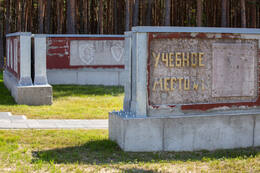
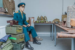
Историческая экспозиция Адажского гарнизона находится в Адажском районе, Кадага, на территории Адажского национального учебного центра. Посетив экспозицию, вы сможете ознакомиться с военной техникой и бытом солдат. Рядом находится крупнейший военный полигон в странах Балтии и уникальная территория для тренировок. История полигона началась в конце 20-х годов 20-го века, он был создан под Ригой, в окрестностях Лиласте. После Первой мировой войны и войны за независимость Латвии в раздираемой войной стране создавалась латвийская армия. Народ Латвии столкнулся с войной и безразличным отношением иностранных армий. За относительно короткое время армия превратилась в многочисленную военную силу большими солдатскими резервами. Полигоны и летние лагеря приблизили повседневную жизнь солдат к условиям войны, позволив им улучшить свои навыки и знания. Железнодорожная ветка Рига-Саулкрасты, построенная в начале 1930-х годов, стала важной для развития полигона Лиласте или Гауя. Она позволяла перевозить боеприпасы и технику, а также служила целям защиты побережья. Во время советской оккупации полигон значительно расширился, символизируя размах милитаризации Советской армии. Гарнизон - набор воинских частей, которые постоянно или временно дислоцируются на определенной административной территории. Полигон - место отработки технических средств и тренировки войск.
Коллекция военных велосипедов в Саулкрастском (Saulkrasti) музее велосипедов
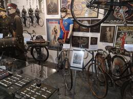
Музей велосипедов находится в Саулкрасты, недалеко от Белой дюны, автомагистрали А1 и железнодорожной станции «Пабажи». Коллекция музея основана на наиболее интересных с технической точки зрения примерах из истории развития велосипедов, найденных в Латвии. Это самая большая коллекция велосипедов в странах Балтии, которая насчитывает около 60 велосипедов произведенных и используемые в Латвии, включая велосипеды армейского образца. В начале 20-го века наличие и преимущества велосипедов стали широко использоваться в армии. Для быстрого передвижения были созданы специальные велосипедные отряды. Велосипедисты легче вели разведку, неожиданно атаковали противника и были более маневренными на обширной территории, чем пехота. После Первой мировой войны в Латвийской армии также были велосипедные подразделения с армейскими велосипедами латвийского производства. Солдат, входивший в состав велосипедного отряда, должен был соответствовать строгим требованиям. Он должен был быть сильным, с хорошим зрением, слухом, здоровым сердцем и легкими. Вес не менее 80 кг, рост 165-180 см.
В латвийской армии было требование, что хорошо подготовленный велосипедист должен преодолевать 80–100 км в течение дня, а форсировано - до 150 км. Зимой, когда нельзя было ездить на велосипедах, ходили на лыжах. Велосипедист должен был уметь пройти на лыжах 50-60 км в день. Многие военные велосипедисты стали профессиональными спортсменами.
Пярнуский монумент павшим в Освободительной войне
Монумент павшим в борьбе за независимость Эстонии был открыт в 1922 году на Пярнуском кладбище Алеви, его автор - известный скульптор Амандус Адамсон. Памятник был открыт в 1922 году на Пярнуском кладбище Алеви. В 1929 году неподалеку от своей работы был похоронен и сам скульптор - профессор Адамсон.
15 апреля 1945 года памятник был взорван, он разлетелся на куски, которые затем были захоронены неподалеку. Статуя "Мальчика с венком" была закопана местными старшеклассницами в 175 метрах от памятника. К счастью, могилы солдат остались нетронутыми.
"
Гарнизонное кладбище было отреставрировано в 1987 году, а части памятника (включая статую "Мальчика с венком") были раскопаны в 1988 году. 24 февраля 1989 года верхняя часть памятника, найденная в земле на своем первоначальном месте, была открыта вместе гранитной табличкой с надписью: "1918 1920 / Здесь 16 июля 1922 года был открыт памятник погибшим в войне за независимость / Скульптор Амандус Адамсон / Разрушен в 1945 /24.II 1989 P.M.S.".
Полная реставрация памятника и кладбища проводилась поэтапно. Памятник был вновь открыт 17 июля 1993 года.

Монумент в честь провозглашения независимости Эстонской Республики
Памятник расположен на площади Независимости в центре Пярну. Выполненный из гранита и спроектированный Каарелом Эльма, Мартом Аас и Микком Мутсо, он был открыт в 2008 году недалеко от театра Эндла того времени.
23 февраля 1918 года "Манифест ко всем народам Эстонии" был впервые публично зачитан с балкона театра Эндла. Манифест был опубликован, и уже 24 февраля в столице Эстонии Таллинне была провозглашена Эстонская Республика. Вся власть переходила Эстонскому комитету спасения, за которым позже последовало Временное правительство Эстонии. 24 февраля 1918 года отмечается по сей день как годовщина основания Эстонской Республики.
Театр был сильно поврежден во время Второй мировой войны и позже снесен.
Памятник изображает балкон исторического театра в его первоначальной величине. Он повторяет текст манифеста как в орфографии оригинала, так и в современном стиле, а также написан шрифтом Брайля.

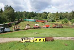
Эстонская Музейная железная дорога
Эстонский музей железной дороги расположен на территории старых торфяных разработок в Лавассааре, в 17 км к северо-востоку от Пярну.
Музей является единственной музейной узкоколейной железной дорогой в стране, здесь среди прочих экспонатов представлен действующий паровоз. В коллекции музея более 80 железнодорожных вагонов, в том числе пять локомотивов и различные технические устройства, большинство из которых выставлено под открытым небом. В бывшем жилом здании работников торфяной промышленности находится выставка, на которой представлено более 700 исторических фотографий, предметов и документов, связанных с узкоколейными железными дорогами Эстонии.
Узкоколейная сеть в Эстляндской и Лифляндской губерниях была создана в XIX-XX веках с целью развития региональной промышленности.
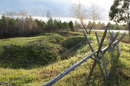
Траншеи Первой мировой войны у пролива Вяйке Вяйн
Хорошо видимый участок траншей Первой мировой войны у пролива Вяйке вяйн расположен рядом с дорогой Куйвасту - Курессааре, недалеко от популярной туристической достопримечательности ветряной мельницы Ээму на острове Муху.
Эти траншеи составляют небольшую часть большей площади оборонительных укреплений и сооружений, охватывающих многие километры. Они были вырыты в 1915-1917 годах в качестве оборонительной меры против наступающей немецкой армии и использовались во время обеих мировых войн.
Отреставрированный объект является наглядным примером военной истории Муху. Эта зигзагообразная траншея хорошо просматривается. До нее легко добраться, так как она находится рядом с главной дорогой, у парковки. Историческое ограждение из колючей проволки только дополняет пейзаж.
Этот пример военной истории дополняет старинную ветряную мельницу Эему, объект промышленного наследия неподалеку. Мельница пережила Первую мировую войну, но была разрушена во время Второй мировой войны, а затем восстановлена в 1980 году.
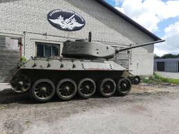
Музей военной атрибутики на Сааремаа
Музей военной атрибутики на острове Сааремаа был создан в 2007 году. Частные коллекции музея состоят из более 12 000 тематических экспонатов.
Музей организует тематические походы и реконструкции исторических сражений, демонстрирующих военную историю XX-го века. Музей, занимающий площадь 650 м2, состоит из пяти выставочных залов, открытых для посетителей, в т.ч. есть и выставка под открытым небом (для более крупной военной техники). Центральным элементом зала Освободительной войны Эстонии является пулеметный вагон бронепоезда № 3. На выставке представлены оригинальная униформа, оружие и другое личное снаряжение времен Освободительной войны Эстонии (1918-1920). В Зале исторической униформы представлена оригинальная униформа Эстонских сил обороны и Кайтселийта (Лиги обороны) межвоенной эпохи (1925-1940), униформа времен Второй мировой войны, а также другое снаряжение. В Оружейном зале представлено европейское огнестрельное оружие и табельное оружие 1450-1970 годов. В Зале личного снаряжения и кухонной утвари времен Второй мировой войны представлен обзор предметов солдатского быта. В Зале технического оборудования выставлены средства связи, пушки, минометы, велосипеды, мотоциклы и автомобили.
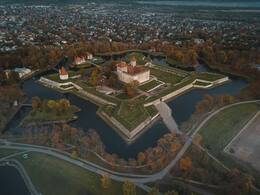
Музей Сааремаа
Юбилей Музея Сааремаа, расположенного в крепости Курессааре, отмечается 17 февраля: именно в этот день, в 1865 году было основано Общество исследования Сааремаа (Verein zur Kunde Oesels). Музей переехал в крепость в 1897 году. Его экспозиция демонстрирует природу и историю Сааремаа. Самым крупным и наиболее примечательным экспонатом музея является сам замок, который является прекрасным примером развития фортификационных укреплений между XIV и XIX веками. Замок Курессааре - одна из самых аутентичных крепостей во всей Северной Европе.
Maantee Military Base
This military base in the village of Maantee is situated on the island of Saaremaa, on both sides of the old highway a couple of kilometres from Sõrve Military Museum.
Construction of the barracks here began in April 1940 after the signing of the Mutual Assistance Pact. The base was constructed by a local company, A. ja M. Edenberg. It comprised two barracks accommodating 350 soldiers, a canteen, a bread factory, a bathhouse, an officers' mess, a clinic and an ice house. The base housed the detachments of the 315th coastal defence battery. Existing farmhouses were demolished to make way for the new facilities, forcing many to move. After the war, the detachments manning the coastal defence batteries in the vicinity were stationed here. The barracks were put back into use during the Cold War, this time by missile troops. In July 1960 the 74907th Division equipped with S-75 missiles arrived here. They began building the Granit missile depot near the barracks. The other barracks housed a single radio-technical company. In 1972, three air defence missiles fitted with nuclear warheads were stored at the Granit depot. The missile unit was disbanded in January 1991. The radio-technical company left the village of Maantee the following year.
Today the buildings are dilapidated to the point of posing a danger. The metal doors of the missile depot have been removed. Nevertheless, the complex remains a popular tourist attraction, albeit one at which visitors must be cautious of the potential hazards.

Coastal Battery No 43 at Sõrve Säär
This coastal defence battery is situated on the shores of the Gulf of Riga in the village of Sääre on Saaremaa.
Sääre was the site of the 43rd coastal battery of the Moonsund forward position of Peter the Great's Naval Fortress, also known as Zerel. It comprised four 305-mm guns. Construction began in 1914, during World War I, on a limited budget. The artillery pieces were mounted in the open on barbettes, with a narrow firing range over Irbe Strait. These were accompanied by ammunition dumps, diesel generators and a command centre built from logs and surrounded by sand. The wooden fire control tower was around a kilometre away at Sääre Manor. A 5 km long narrow gauge railway was laid connecting the battery with the port in Mõntu.
The concrete artillery barbettes with their rounded bolts, defensive walls of two of the artillery positions and the mound of sand on which the command centre once stood are all that remain today.
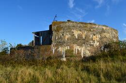
Papissaare Seaplane Base
This seaplane harbour is situated on Papissaare Peninsula, to which an historic cobbled road leads from the small borough of Kihelkonna.
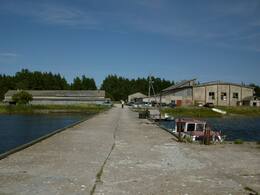
Papissaare Seaplane Base, which formed part of Peter the Great's Naval Fortress, was established between 1912 and 1914. It comprised two aircraft hangars, equipment and ammunition warehouses, a fuel tank, an electric generator, barracks, a canteen, a bread factory and a bathhouse. In August 1914, nine aircraft were brought here from Liepāja. On 12 October 1917 German forces captured the base and destroyed most of the buildings. During the interwar era the complex was the site of Julius Teär's Shipyard.
On 24 October 1939, Soviet forces acquired the complex under the Mutual Assistance Pact and restored it as a seaplane harbour. The MBR-2 seaplanes of the 15th Aviation Squadron stationed here fought in the Finnish Winter War. In late summer 1941, German bombers obliterated the seaplanes. The Soviet squadron abandoned the base, setting it on fire as they did so. From 1940-1960 the whole peninsula was a restricted military zone. Later, the complex was used by the local fishing collective. Today the remaining buildings are in use as workshops and warehouses.
This historic seaplane harbour has become an important tourism port, providing passage to the unique island of Vilsandi.
Undva Naval Radio Communication Center
Undva is situated in the north-eastern part of Tagamõisa Peninsula in north-western Saaremaa. In August 1940, Soviet forces and locals recruited for construction began building the 32nd Military Base in Undva. After World War II, the Soviets built two 127-mm artillery batteries here, one near Suuriku Bank and the other on Cape Undva. The latter was later replaced with a more modern coastal defence battery, which preceded the construction of a radar station in the 1960s. The four concrete barbettes, concrete hangars and the remaining complex are in good condition.

Panga Military Trail
This military hiking trail is situated on the north coast of Saaremaa, 1.5 km north-west of the village of Panga. The most convenient access to Panga is via Võhma.
The trail is situated along Panga Bank, which is the highest bank of exposed bedrock anywhere in Western Estonia and on the islands. Its length and openness to the sea are what make the bank special in terms of terrain and attractive to tourists. It is situated in Panga Nature Park, surrounded by the Baltic Sea to the north and north-east, by the mouth of Küdema Bay (an important bird site) to the west and by forests to the south and east.
Panga Bank did not see any active combat. The area was used for defence purposes, as it was a restricted access zone on the border of the Soviet Union.
The sundial marks the place where a searchlight once stood, guarding the national border.
Today the 2 km long military hiking trail passes by the ruins of a variety of military facilities.
120-mm Coastal Battery No 34 at Hindu (Sõru)
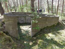
The construction of the battery began in 1914. As it was an additional battery, missing in the original plan of the naval fortress and the type of guns was repeatedly changed. Finally four 120- mm Vickers guns were installed. A 200-m length and 10-20-m width sandbar was piled up in defence of the gun emplacements and covered in concrete above the guns. Hindu was the only battery in Hiiumaa that participated in combat operations during the Tagalahe landing on 12 October 1917. After a brief exchange of fire with the German warships the Russian artillerymen fled, leaving the battery intact. The Germans sent a landing unit of soldiers inland that blew up the guns of the battery. One of the German warships that shot Hindu battery, was ’Bayern’, the warship with the largest displacement that has ever been in the Estonian waters (length 180 m, displacement 32 200 tons, eight 380-mm guns).The building of the battery radio station was transported to Emmaste and was used as the community centre (demolished in the 1980s). The gun barrels and other larger details were still there in 1937. Today the first and the second gun platforms are still identifiable, the other two are situated on a fenced farmyard. The third gun crater is filled with earth and there is a newly built house facing the sea, the remains of the fourth one is merely a cracked concrete platform. Out of two air defence gun platforms, one survives (a hundred metres toward the nursing home, on the right side of the road). There are no intact buildings. The machine gun bunker between the first and the second emplacement was completed in 1941.
Concurrently with the construction of Hindu battery, there was a plan to build something in Lepiku village where large gravel bars were piled up, still visible today. It is unknown what the building was going to be.
130-mm Coastal Battery No 44 at Tohvri (Hindu)
A building battalion of the Red Army arrived in Hindu village in October 1939. The local population was ordered to leave their homes before winter. By the following spring the battery area was surrounded by a wire fence. Building material arrived via Sõru Port where work was done in 3 shifts, 24 hours a day. At least a hundred local men were employed to build the battery. Concrete mix was manually made in large tubs, foundation holes were dug. The barracks were going to have two storeys, the second storey angle iron framework was completed when the top committee came to check on the construction. An order was given to demolish the second floor because it was visible from the sea. By the autumn of 1940 two barracks, two officers’ residential buildings, a canteen, two saunas, a food cellar, two firefighting water reservoirs and a gate guard post were completed. A large-scale construction was to continue and there were a couple of thousands of tons of cement in the depots.
The crew of the battery included 5 officers and 125 lower rank soldiers. The test firing of guns took place in summer 1941 when boat-like vessels with masts towed by tugboats on long wire ropes appeared. The battery was never fully completed, some of the shelters and the water reservoir are not covered with earth. The armoured doors were probably never fully installed. Just the concrete floor of the gas shelter (shelter-power station) with its spiky reinforcement iron bars got completed. One gun and its crew were taken to Heltermaa in September 1941. During the German landing in October an ammunition shelter together with the rest of the battery’s ammunition were blown up. The powerful explosion ripped and scattered the walls of the explosive charge room and raised its roof into the air which broke in two after falling on the standing wall.
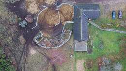
The other three gun blocks have survived more or less intact and dry. Recently, the area has been cleared and the positions can be fairly easily identified. The command post is half filled with water the whole year round. Due to its wet location the ferroconcrete and bricks are in a notably worse condition than in Tahkuna.
Around the battery there are five machine gun bunkers, each of a different construction. A couple of hundred metres to the Northwest of the battery position there is a small open observation post. There are two machine gun bunkers by the base as well. Near the upper lighthouse of Sõru there are the ruins of a machine gun bunker with a shooting sector of laid bricks. At least 15 such weapon pits were built between Tärkma and Õngu in 1941.
In 1944–1945 the battery was reconstructed with three 130-mm guns. The last training shots were taken on 23.09.1957. The following March the guns were taken away and then the battery was closed down. Today the former base accommodates Tohvri nursing home.
Orjaku Military Harbour
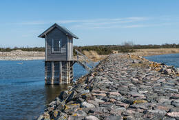
Orjaku harbour was intended to be used as an Imperial Russian Navy base for torpedo boats. Construction began in 1912, only to grind to an indefinite halt following the outbreak of World War I. Just two breakwaters had been completed by this point, which encompass the harbour to this day. During the final years before the Soviet occupation, a channel 4 metres deep, 35 metres wide and 2.2 km long was dredged.
Ristna Lighthouse
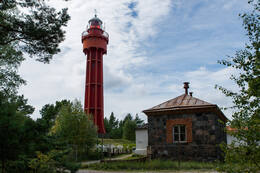
This 30-metre, cast-iron lighthouse was assembled in 1874 from components manufactured in France. The lighthouse was badly damaged during World War I and was reinforced with a concrete outer structure in 1921.
The lighthouse itself is 29.5 metres high, while its light towers 37 metres above sea level. The light can be seen from 31.5 km away.
The lighthouse was also tasked with warning vessels about the ice conditions in the Baltic Sea, alerting them with a blinking red light if the nautical channels were blocked by ice.
This lighthouse is connected to events of the First World War: On 12 August 1914 at 4 AM the German cruiser Magdeburg fired at the Ristna lighthouse and the communications outpost on Cape Ristna. This marked the arrival of the First World War on Estonian territory. Ristna lighthouse was used for communication between patrolling British and Russian submarines and the naval base in Tallinn. Radio communication was avoided. The submarines surfaced at the agreed-upon location and sent their communication officers to the base by the lighthouse to make contact with Tallinn on the phone to receive further instructions. On the same day the Russian Navy used a fairly rare contraption of that time, a hydrophone, to record any noise generated by ship propellers on Cape Ristna. The coastal outpost and cables were destroyed while the Russians retreated, the remains of the hydrophone are still deep on the sea floor to this day, its location unknown. It is worth mentioning that the fog siren building erected in the early 20th century is one of the few surviving fog siren buildings of Estonian lighthouses.

Hiiumaa Military Museum
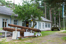
The Military Museum in Hiiumaa is located in the former Tahkuna border guard cordon. The museum's pride is its collection of coastal defense artillery barrels - 180 mm, 130 mm and 100 mm gun barrels are represented here. The outdoor exhibition features armored personnel carriers BTR-70 and BRDM-2, ZIL-157, GAZ-66 and other vehicles, civil defense shelters, a border guard cutter, sea mines, an anti-tank gun, a border guard observation tower, radars and radio masts. The main building of the museum houses a sea surveillance radar in its original place. Gun ammunition and shells, helmets, hats and uniforms, communications equipment and civil defense equipment are on display.
The 130-mm Coastal Battery at Tahkuna No 26
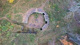
The 130-mm battery at Tahkuna is architecturally similar to the battery at Tohvri. The ferroconcrete surfaces in the gun emplacements bear the inscripted date 20/IV 1941. In 1941 the battery had four 130-mm B-13 guns (weight of gun including shield 12.8 tons, crew 11, shooting range up to 25 km). The crew included 151 seamen and 9 officers. The guns were installed right before the battles of October 1941.
The ferroconcrete gun blocks remained intact in the war and the crew arrived as early as October 1944. First the battery had three 130-mm B-13 guns. The last shots were fired in Tahkuna in January 1960 when there were 4 guns. When the battery was operating, the last kilometre of the road leading to the lighthouse was closed by a barrier and a gate house and this part of the road is still missing on the military topograhic map published in 1959.
The buildings of Tahkuna battery have survived in a fairly good state. In the ammunition depots next to the gun blocks occasional shell shelves have survived, they can also be found in the ammunition depots in the rear of the emplacements. The shelter-power station (the gas shelter) still has bunk beds. Between the boiler house and the diesel power station there is a particular water line hidden in a high parapet with a concrete reservoir at both ends. A fire control tower was built next to the command post in the 1950s and after the battery was closed down, it was used as an observation post of the naval radio technology unit. As the forest kept growing and the seaview got worse, the tower gained another floor. This new addition demonstrates a notably poorer building quality in comparison with the rest. The added floor includes a stove, whereas originally the tower had central heating. On the whole territory of the battery there are cable ditches that have been dug open – dating from the 1960s when the collective farms were permitted to take electric gear from the abandoned batteries, as well as from the early 1990s when all the cables that had been meanwhile installed and could be spotted, were taken. With the territory being completely neglected and heavily overgrown, finding and studying the objects could be complicated.
On the territory of the battery, next to the parking lot, there is a monument from 1968 in memory of the Baltic Navy soldiers who perished in 1941. The author of the monument is Vitali Navoznyhh, originally from Leningrad. He participated in the battles of 1941 in Hiiumaa and settled on the island after the war, working as a stonecarver. Next to the monument there is a tombstone to two unknown soldiers who were buried there in 1973.
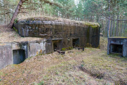
Railway and Communications Museum in Haapsalu
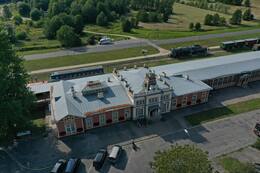
This museum is housed in a train station built in the early 20th century to service the railway line connecting to the resort in Haapsalu.
Opened in 1997, the museum showcases the one-and-a-half centuries of development of Estonian railways and mediums of communication. Besides decommissioned locomotives, the museum displays an affable station master and an Ericsson Skeleton Type telephone and invites visitors to the station's post office.
The outdoor exhibition also displays a World War II steam locomotive 52 3368.
The steam locomotive 52 3368, initially numbered 16494, was completed in April 1943 in Munich at the Krauss-Maffei Works and then transported to Austria, the Bruck an der Mur depot of the Villach division. The Hungarian State Railways (MAV) rented the locomotive and on June 7, 1945, it was captured by the Red Army. When the Hungarian-Romanian border was altered, locomotive 52 3368 was given to the Romanian railway (CFR). In August 1950, at the CFR Iași Works the locomotive was converted to broad gauge (5 ft) and given to the Soviet Union, where it operated at the Kotovsk and Vapnyarka depot of the Odessa Railway from October 1950 to 1956. After that, the Ministry of Transportation of the USSR kept it in the strategic reserve. On August 26, 1957, the locomotive TE-3368 (ТЭ-3368, the class 52 was renamed as TE in 1952) arrived at the Valga locomotive base. There the loco got another tender (so-called Wannentender), built in 1943 by Borsig Works in Berlin and formerly belonging to locomotive TE-450. It could carry 32 m3 of water and 10 tonnes of fuel. The locomotive stayed in Valga (from 1961 to 1968 shortly in Tartu) until the base was closed in 1997. From 1950 to 1985, its kilometrage as a broad-gauge locomotive was 463,216 kms. On May 8, 1998, the steam locomotive was delivered to Haapsalu to be exhibited at the Railway Museum.
The class 52 war locomotive was designed in a hurry in June 1942 on request of the Reich´s Ministry of Armaments and War Production in the example of the class 50 locomotive. The 2-10-0 type engine had a power of about 1,500 hp and a maximum speed of 80 km/h. It had a simplified and light design (15-ton axle load) with an intended life-span of 5 years. From 1942 to 1945, a total of 6,295 locomotives of that class were built in 14 factories across Europe. After World War II, the class 52 locomotives had spread all over Europe, from Norway to Turkey and from Belgium to the Soviet Union. There were over 2,000 locomotives in the USSR – the exact number remains unknown, as the locomotives were subject to different authorities, including security authorities. In Estonia, the class 52 steam locomotives ran first on standard-gauge (1,435 mm) lines in 1943–44. Since 1953, when they replaced the American class ShA war locomotives (the Shariks) in Estonian freight traffic, 138 class TE (52) regauged locos have been here. By 1991, only one remained in Estonia – the TE-3368.
Estonian War Museum - General Laidoner Museum
This museum, which has been housed in the mid-19th century historicist Viimsi Manor since 2001, conducts research into and both preserves and displays Estonian military history. Its predecessors were the Estonian War of Liberation Museum (founded on 19 January 1919) and a museum dedicated to General Laidoner established at the manor by decree of Viimsi Municipal Government in 1993. During the Soviet occupation, the manor was used by a naval intelligence unit: after the withdrawal of the Soviet Army, the building was in a dire state. The museum was founded by decree of Minister of Defence Jüri Luik on 26 February 2001. Since then, the museum has operated under the jurisdiction of the Ministry of Defence. Its main exhibition showcases wars fought in Estonia and abroad in which Estonians have participated. Part of the exhibition is dedicated to Commander-in-Chief Johan Laidoner, who owned the manor from 1923-1940. The military equipment hangar near the main building displays a variety of artillery pieces and vehicles.

Seaplane Harbour
The Seaplane Harbour is situated on the water’s edge in the Kalamaja district of Tallinn.
It was commissioned during World War I by Russian Emperor Nicholas II as part of Peter the Great's Naval Fortress. The museum, based in the historic seaplane hangar, has around 200 original exhibits on display: the submarine Lembit, the 100-year-old icebreaker Suur Tõll, the seaplane Short 184, the oldest Estonian shipwreck, mines, cannons and more. Temporary exhibitions complement the main exhibition. The seaplane hangar is architecturally unique: its domed roof was one of the first thin concrete shell structures of its kind.
The museum’s programmes and materials for individual visits are fun and educational for adults and children alike.

Hotel Viru and KGB museum
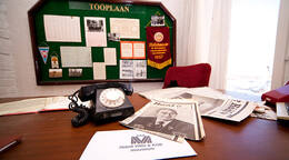
Hotel Viru in Tallinn was built in 1972. The hotel for foreigners also had to suit to the national security body, i.e KGB. The museum tells the story of more than just one hotel and the KGB. It is a treasure trove of stories of two different worlds - one which existed mostly on paper, of happy Soviet citizens living in friendship and never wanting for anything, led by a wise, all-powerful group of men in a place where there were never any accidents or catastrophes; and the other real world, which was a very different and a much tougher place to live in.
Please book in advance to visit the museum.
Patarei Naval Fortress
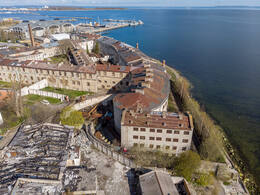
A former naval fortress located in the Kalamaja district of Tallinn.
Designed by military engineers Étienne-Louis Boullée and Claude-Nicolas Ledoux, Patarei was commissioned in 1829 by Russian Emperor Nicholas I. The complex was opened in 1840, but this did not mean that construction work was complete. The fortress underwent renovations: there were fears that the British and French would attack from the Baltic Sea after the outbreak of the Crimean War in 1853. This did indeed come to pass, but it did not escalate into large-scale warfare. Only a few shots were fired from Patarei. As a result of the adoption of explosive projectile, Patarei was decommissioned as a fortress in 1858 and was thereafter used as barracks. During the era of Estonia’s independence, Patarei was turned into a prison, which operated until 2002. It had also been used as a prison during the German and Soviet occupations. The atrocities committed there by those regimes made the place infamous among the population. The architecturally prominent building, which covers four hectares, is now home to an exhibition entitled ‘Communism is Prison’, which shines the spotlight on communist ideology, communist crimes and the history of the building. Renovations of this remarkable architectural wonder covering four hectares began in 2020. By 2026 Patarei shall be an integrated urban landscape complete with commercial space, living quarters and leisure options. The original prison interior and exercise yards shall be preserved in the eastern wing of the building. Already there's an exhibition on the communist ideology and atrocities and the history of the building covering close to 1200 square metres.
Vabamu Museum of Occupations and Freedom
Vabamu museum is situated in the centre of Tallinn.
A private museum, it opened in 2003 to showcase Estonian history from 1940-1991. The museum recalls stories from recent history highlighting both the value and fragility of freedom.
The main exhibition and the films shown at the museum provide an overview of the Soviet occupation, oppression, national resistance and the Singing Revolution.
The main exhibition, ‘Freedom Has No Limits’, is divided into five topics: ‘Inhumanity’, ‘In Exile’, ‘Soviet Estonia’, ‘Restoration’ and ‘Freedom’. Museum visitors can take an audio tour (in Estonian, Russian, English, Finnish, German, French or Spanish) to guide them on this immersive and retrospective journey through history. There are also activities for children, offering an unforgettable experience for the whole family.

Hara Harbor and Submarine base
Hara Harbour is situated in the village of the same name in Harju County.
There was a border guard outpost on the shoreline facing the island of Hara which was used during both the imperial era and the era of independence prior to World War II. The outpost was taken over by the Soviet Border Guard during the occupation of Estonia. A military harbour – the historic Hara submarine base or degaussing station – was constructed nearby. Degaussing was done using underwater technical facilities and enabled ship and submarine hulls to repel magnetic mines.
The whole port area used to be a restricted zone. Currently the port houses a visitor centre and is used as a marina. The history of the base can be explored on site, with the quay and ruins also accessible to visitors.

Sinimägede (Blue Hills) battlefield memorial
This memorial is situated on the western slope of Grenaderimägi Hill in the Blue Hills near the old Vaivara cemetery.
It symbolises the battle fought in the Blue Hills during World War II between Soviet and German forces.
The first monument in the Blue Hills area – a 6.5-metre wooden cross – was erected here in 1994. The current memorial was completed in 2000. The 12-metre steel cross, which towers over a hectare of land, was designed by artist and blacksmith H. Müller. In the middle of the cross is a composition depicting an explosion. In 2004, a monument in honour of the 20th Waffen Grenadier Division was added to the memorial. Two years later, monuments commemorating the Dutch and Walloon volunteers who fought alongside the Estonians were added.
Grenaderimägi Hill regularly changed hands from one battle to the next. The last point of defence, known as the ‘Hellhole’, was around 100 metres to the east of the memorial cross.

Vaivara Sinimägede Museum and Battlefield Memorial
This museum is located in the renovated barn of Vaivara Manor in the small borough of Sinimäe.
Its exhibition showcases the World War II battle of the Narva River and the Blue Hills in 1944. It displays firearms, uniforms, soldiers' personal belongings, wartime photographs, propaganda posters from both sides and more. A big screen shows historical films and documentaries. Despite the topic of war being difficult for some, the exhibition is intended for all ages: while parents can concentrate on the history and the details, the children can interact with the items on display. Historical battlefronts (the 3rd defensive line of St Petersburg and the German East Wall defensive line known as the Tannenberg Line) can be found near the museum.

Memorial to the Avinurme Battle
This memorial is situated close to the church and graveyard in the small borough of Avinurme.
The battle took place in 1944 and forced Estonians to fight one another: the battalions of the 27th and 921st Estonian Rifle Regiments on the Soviet side, and the Estonian Waffen Grenadier Division of the SS and units of the 300th Special Infantry Division on the German side.
In 1964, a monument was placed in front of the church in Avinurme reading: "Glory to the heroes who fell in Avinurme for the liberation of our homeland. 20. September 1944".

Sculpture of the Mourning Maiden. Mass grave of people killed in World War II
The statue of the Mourning Maiden, which marks a mass grave of people killed in World War II, is located in the town of Mustvee by Lake Peipsi.
In 1944, Red Army soldiers killed in Mustvee and the surrounding woods were buried here, in the abandoned Old Believers' cemetery. Soviet Army sources state that 264 Soviet soldiers killed in World War II are buried in the mass grave.
On 8 May 1973, a bronze statue sculpted by Elmar Rebane entitled ‘Mourning Maiden’ was placed here, along with a tombstone marking the mass grave.

Jõgewa Military Museum
This museum is situated by the Tartu-Jõgeva-Aravete road in Jõgeva.
It grew out of an exhibition entitled ‘1900-1945’ showcasing exhibits gathered and curated by military history enthusiasts. The museum opened in 2012. It displays local archaeological findings, military and civilian memorabilia, significant cultural exhibits and a wide range of weaponry. It also presents the history of military conflicts from the Stone Age through to the modern era. The museum has a study room for educational programmes, such as “Don't touch bombs, children!” for schools.
The museum reserves a special place for an exact copy of an Arsenal-Crossley armoured car from 1927, which was researched and built by museum staff in 2018 for the centennial celebrations of the Republic of Estonia.

Museum-Room of the Finnish Boys
This museum room is situated in Saadjärve Nature Centre in the small borough of Äksi.
It was opened in 2002 on behalf and with the support of the Finnish Boys Association, Tartu Municipal Government and the Finnish state.
It provides an overview of the battles in Finland and Estonia in which the Finnish Boys participated during World War II. Here you will see a scale model depicting the battles fought in Jõgeva and Tartu counties and the uniforms, equipment, armaments, military decorations, personal belongings and photos of the Finnish Boys. The bunker is also open to visitors.
Free admission.

KGB Cells Museum
This museum is situated on the corner of Riia and Pepleri streets in Tartu.
It is a branch of Tartu City Museum. The museum is located in the infamous grey building on Riiamägi Hill that the KGB used as their base of operations in Tartu during the 1940s and 1950s. The basement here was used as a pre-trial detention centre for political detainees. Now, many years later, it is open to visitors. Some of the cells (including those used for solitary confinement) and part of the corridor have been restored to their original appearance. The exhibition in its former jail cells provides an overview of World War II, the post-war anti-Soviet resistance in Estonia, the crimes committed by the communist regime and the conditions in the detention centre. The idea of opening the museum came from members of a former underground student resistance group in Tartu called Blue-Black-White, who discovered upon visiting their former cells that the basement had been abandoned and that it would not be very difficult to restore the former look of the jail. The museum was officially opened on 12 October 2001.
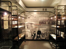
Raadi Military Airfield
This airfield is a former air base on the north-eastern outskirts of Tartu.
On 14 April 1912 Russian pilot Sergei Utochkin made history by completing the first motorised flight in Estonia, in a Farman biplane above Raadi Manor. Baron Liphart, the lord of the manor, had his farmland converted into a runway in summer 1914. During the interwar period of Estonian independence, the 2nd Squadron of the Aviation Regiment was stationed in Raadi. During the 1950s and 1960s the airfield was refashioned into one of the largest air bases in Eastern Europe, at which strategic long-range bombers were stationed. The last landing in Raadi is believed to have taken place in 1996. Plans for renovating the airfield were abandoned in 1999. The airfield has since been decommissioned.
It is situated next to Raadi Manor. In 1922 the Estonian National Museum was established in the manor, which had been expropriated from the Lipharts in 1919. Aerial bombings in August 1944 set fire to the manor, and it burnt down. In 2016 the new building of the Estonian National Museum was opened in Raadi, located at the end of a former runway. The building, which is 350 metres long and rises from the ground, gives the impression of being an extension of the runway.
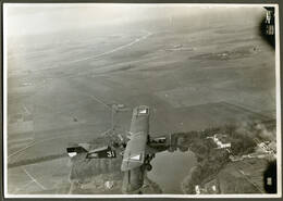
Tartu Anti-Tank Line – Jalaka Line
The Jalaka Line (named after the Chairman of the Executive Committee of Tartu, Kristjan Jalak) was an anti-tank trench dug alongside the Riga road near the village of Räni four kilometres outside of Tartu in summer 1941 as a countermeasure against the German offensive.
Part of the line is situated in Lemmatsi, another village outside of Tartu by the E264 towards Valga. The other part was established on the right bank of the Emajõgi River stretching from Kärevere to Praaga.
Citizens of Tartu aged 16-55, men and women alike, were forced by the Soviet regime to construct the fortifications for the Jalaka Line. The German regime used the trenches in 1941 and 1942 to execute those in its Tartu concentration camp who had been sentenced to death. During the Soviet era a monument was erected, designed by Elmar Rebase and Väino Tamm, in memory of the victims of terror.
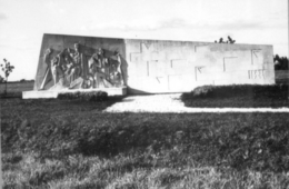
Monument to the War of Independence in Rõngu
This monument is situated in front of the historic Kõvera tavern (built somewhere between 1807 and 1830) in the small borough of Rõngu.
Designed by sculptor Aleksander Eller, the monument was unveiled on 30 September 1934. The bronze sculpture mounted on its granite base depicts the Estonian epic hero Kalevipoeg defending his mother Linda, symbolising the Estonian nation, with a sword. The sculpture was destroyed in October 1940, but then restored during the German occupation and unveiled anew on 12 October 1941. The monument was fully demolished in 1948. The current monument, slightly altered by Villu Jaanisoo, was unveiled on 21 May 1995. It differs from the original by having the statue of Linda at the top and the statue of Kalevipoeg, resting on his sword, placed in front of the monument.

Monument of Paju Battlefield
The Battle of Paju took place on 31 January 1919 during the War of Independence between the Tartu-Valga army group of the Estonian People's Force and the Red Army Latvian Riflemen for control over Paju Manor. The battle resulted in the Estonians gaining control over the strategically important town of Valga and its railway turnout. Julius Kuperjanov, who led the Estonian offensive, was fatally injured in the battle.
This monument was designed by architect Georg Saar. A campaign was organised to raise money for the monument. On 12 June 1938, the cornerstone was laid by General Johan Laidoner. The base was completed in 1940, but the monument itself went unveiled due to the Soviet occupation. On the 75th anniversary of the Battle of Paju on 30 January 1994, President Lennart Meri finally unveiled the monument.
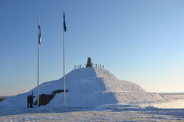
Valga Military Museum – Theme Park
This museum and theme park showcases the internal security and military history of Valga and Estonia. The place is perfect for organising summer camps with field activities and a field trip to a World War II battle site near the Väike-Emajõgi River. The programme includes learning to cook pea soup (a popular dish in the military), using camouflage face paints and orienteering in the woods.
The exhibition at the theme park includes military equipment, artillery, an Mi-8 helicopter, a fire engine and various types of machine gun pillbox and naval mine. The tour ends at a Forest Brothers’ bunker, where, on prior request, an alcoholic beverage drunk by the Forest Brothers and smoked lard sandwiches with onion are served. For more serious enthusiasts, the museum displays the largest collection of weapons in Estonia. The Estonian Defence Forces, Police and Border Guard Board, Defence League and Internal Security Service organise demonstrations at the museum of the duties they carry out. They are joined in doing so by the Latvian Police, Border Guard and Fire and Rescue Services.
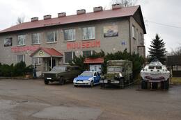
Valga railway station built by German prisoners of war
The main building of Valga railway station (Leningrad Transport Planning Office, architect: Viktor Tsipulin) was completed in 1949. It is an elongated two-storey structure with an avant-corps and a hipped roof, its architectural showpiece being its seven-storey square tower. It is one of the best and most remarkable examples of Stalinist architecture in Estonia. Its original state having been so well preserved further elevates its significance. The railway station was built shortly after World War II in place of a building from the imperial era that Soviet bombing had razed to the ground. Since German prisoners of war were detained in Valga, it is plausible that they were used to construct it.
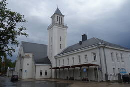
Exhibition “Valka - the Cradle of Latvia’s Independence”
The Valka Local History Museum is located in Valka, on the right side of Rīgas street, in the historical building of the Vidzeme Parish School Teacher Training Seminary. From 1853 to 1890, the building was home to the Vidzeme Parish School Teacher Training Seminary. Until 1881, it was led by Jānis Cimze, a teacher and founder of Latvian choir culture. After the School Teacher Training Seminary was closed, the building served various educational, cultural and household needs for 80 years. The building has been home to the Valka Local History Museum since 1970. The museum’s permanent exhibit – ‘Valka, the Cradle of Latvia’s Independence’ – has been set up as a story about social and political events in Valka from 1914 to 1920 when Latvia became an independent state. The exhibit reflects the preparation leading up to the establishment of the Latvian state and the formation of the North Latvian Brigade in Valka. Through four senses, namely, the Road, the Council, the Headquarters and the Home, the exhibit focuses on topics related to the city of Valka, refugees, the founding of the Latvian Farmers’ Union (1917), the
Latvian Provisional National Council (1917), the Latvian Provisional National Theatre (1918), the Provisional Government of Soviet Latvia known as the Iskolat, the North Latvian Brigade (1919) and General Pēteris Radziņš. In addition to the traditional ways of showcasing collections, the exhibit makes use of interactive multimedia solutions.
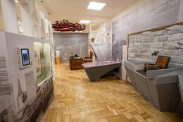
Memorial to the soldiers fallen in World War II
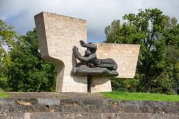
The memorial ensemble in Valmiera was unveiled in 1985. World War II Soviet soldiers who fell in the vicinity of Valmiera and victims of Nazi terror have been reburied in the Brothers’ Cemetery. The authors of the memorial ensemble are sculptors Zigrīda Rapa and Juris Rapa, architects Ēvalds Fogelis, Jānis Lejnieks, Jānis Rutkis and Andris Vītols, and Design Engineer Ivars Veldrums. Limestone from the village of Allaži was used to decorate the memorial ensemble. Its main image is the split linden tree of the Coat of Arms of Valmiera city. Two sculptures on each side of the ensemble symbolise the rhythm of life and death. The figures facing the Gauja river form a semi-circular space, marking the boundary between the past and the present. The main image facing the city is part of an intense arch-shaped form. The figure of a soldier faces the visitors approaching from the side of the city by the bridge, with the diagonal shape formed by the soldier’s hand supporting his deceased companion. On the burial terrace, soldiers have been laid down in rows for those who fought shoulder to shoulder in battle to lie under the same turf. A composition named the Golden Apple Tree lies separately on the lower terrace of the memorial. A granite plaque commemorates the Jews reburied here. Some of the elements, including bronze apples with the ensemble’s message encrypted by the authors, which had been placed under the growing apple tree, disappeared in the 1990s. A QR code next to the memorial gives visitors access to an audio guide with the information available in Latvian, Russian, English, Estonian and German.
Exhibitions of the Cēsis History and Art Museum in the New Castle
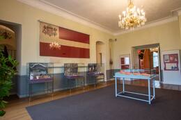
The Cēsis History and Art Museum is located in the very centre of the Old Town of Cēsis, in the New Castle. The museum holds a permanent exhibit of history and interiors named ‘Cēsis, a Symbol of Latvian History’, with two thematic sections: the exhibit ‘Red-White-Red Flag in the History of Cēsis and Latvia’ explains the history of the Latvian national flag from the 13th to 20th centuries, the approved national symbol, the flags of Latvian rifle battalions and the traditions of using national colours during the Latvian War of Independence. The exhibit ‘Cēsis and the Latvian War of Independence’ focuses on the founding of the Cēsis Company in December 1918, the joint battle efforts of Estonians and Latvians in the 1919 Battles of Cēsis, the time when, during the Bermondt Affair, Cēsis served as the temporary capital of Latvia for a short time, as well as the history of the Cēsis Victory Monument. In an escape room named ‘Legends of the Battles of Cēsis’, the participants have one hour to find their way out by solving puzzles, making connections and finding hidden objects. The Cēsis Company, one of the first units of the Latvian Armed Forces, was established on 8 December 1918 in Cēsis Castle by Senior Lieutenant Artūrs Jansons. The museum’s exhibit features a memorial plaque dedicated to the Cēsis Company, unveiled on 8 December 1933 at the Cēsis New Castle, which, at the time, served as the headquarters of the 8th Daugavpils Infantry Regiment and the garrison officers’ club.
Secret Soviet Bunker in Līgatne
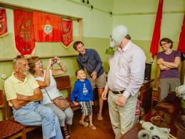
Located in Līgatne parish, Cēsis municipality, the Soviet Secret Bunker lies 9 metres below the Līgatne Rehabilitation Centre building and its adjacent territory. The bunker is open to visitors and offers guided tours, meals in the bunker canteen, Soviet-style parties and the reality game Object X. The purpose of the bunker was to provide the minimum necessary conditions for long-term work for the Council of Ministers of the Latvian SSR, the leadership of the Communist Council of the LSSR and the management of the LSSR state planning committee in the event of a nuclear war threat. The 2,000-square-metre underground bunker was the strongest autonomous structure with all the required and most state-of-the-art equipment of the time, and also one of the most strategically important sites in Soviet-era Latvia in the event of a nuclear war. The site has a protected underground workspace (shelter), a sanatorium-type sleeping block for 250 people, security facilities and a 24-apartment residential house for service staff. All of the authentic underground equipment and plans have been preserved to this day. Highlights include an autonomous power plant with diesel generators and fuel storage, conditioning equipment for air purification with oxygen reserves, water supply and sewerage equipment operating on the submarine principle, a telecommunications unit capable of providing direct contact with the Kremlin in Moscow and autonomous communications with all major services in the country, a unique map with historical names of collective farms, an authentic canteen with typical Soviet-era meals, as well as various Soviet-era attributes and household items.
Museum of Battles in More
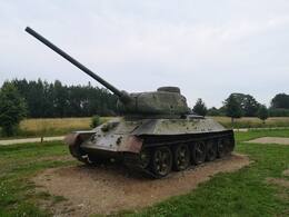
The museum is located in More, on the side of the V319 motorway. It is dedicated to the Battles of More between the Red Army and the Latvian Legion of the German Army in the autumn of 1944. The exhibit includes a mock-up of the battlefield, weapons, awards, soldiers’ uniforms and military equipment. The Battles of More Museum and Memorial Park was established by former soldiers of the Latvian Legion who participated in the Battles of More. The memorial park features trenches, dugouts and battlefields. The battles in the More area were only part of a large-scale operation of the Red Army Baltic Offensive involving a total of 900,000 soldiers and large numbers of military equipment units. A part of the German Army fortification system where Latvian legionnaires prevented the Red Army’s attempt to break out to Riga was located in the vicinity of More. This allowed the German Army to withdraw its forces from Estonia and avoid defeat. Red Army leaders expected the enemy’s resistance near More to be short-lived and stubbornly continued its unprepared and uncoordinated attacks, suffering heavy losses. Local advantages and the combat capabilities of the Latvian legionnaires played a significant role in the subsequent course of the war. More is home to the Latvian Legionnaires’ Brothers’ Cemetery and a Red Army Soldiers’ Cemetery.
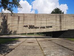
Salaspils Memorial Ensemble
Salaspils Memorial and historical exhibit is located in Salaspils municipality, 1.2 km from the Riga-Daugavpils A6 highway. The Salaspils Memorial was unveiled in 1967 on the site where during World War II the Salaspils Camp was once located. It is a place that was used for Soviet propaganda and is shrouded in myths and half-truths. It is a good representation of the Nazi crimes and Communist ideology that was carried out during each of the occupations. This repressive camp was a part of the German penitentiary system. It had similarities with concentration camps, but it was not the same thing. It was created so that there would not be a disproportionate number of prisoners in Riga prisons. This camp was an “extension of the police prison”. And a variety of people were imprisoned here – Jews, the Red Army prisoners of war, absentees, political prisoners, criminals, prostitutes, members of the Latvian resistance movement, Baltic soldiers in the German Army or police, and others. The camp could hold up to 2,200 prisoners. The main cause of death (~2000) was malnutrition, working conditions, corporal punishment and illness.