
Former World War I narrow gauge railway branch: “Banhoff – Bhf. Waldl. Salit” site
Infrastructure


 40
40


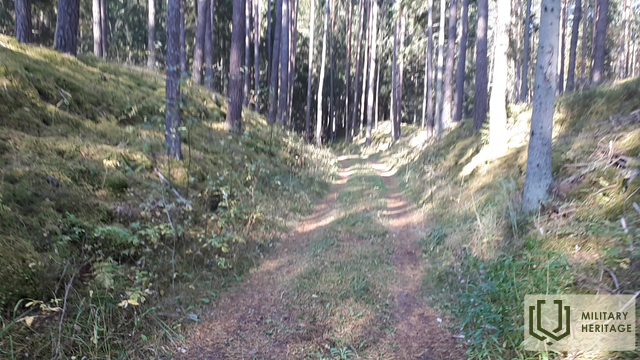
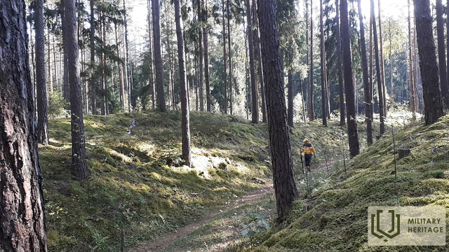
To the south and north of the Baldone-Tomes road, V4 (called “Düna Straße” on the World War I map), a narrow-gauge railway system was established during the First World War to meet the needs of the front. South of the mentioned road was the “Bhf. (Bahnhoff) Waldl. (Waldlager – “Forest camp or warehouses”) Salit” – station “Forest camp/warehouses? The location of the railway line can be traced both on maps of different times and scales and on LIDAR maps, and also in nature. The mentioned railway section branches off from the modern Vecumnieki station (Bhf. Neugut Kurland) – Mercendarbe (Merzendorf) broad-gauge railway approximately a kilometer east of the Gēdiņi houses (station – “Bahnhoff Gedeng”). The first kilometer of the railway line from Gēdiņi station is nowadays covered by forest and in order to find the location of the line in nature, you need to bring LIDAR maps and patience, wading along the overgrown, but still visible railway embankment. On both sides of the railway line, by the adjacent road and in the dune embankment (south of the road), at least 20 deep, rectangular pits (warehouses?) are visible in nature. In the following The 1.3 km railway line can be traced in nature as a nice, clear forest road, which in places crosses small dune embankments with excavations in them. Further - for 3.5 km, the railway line coincides with the road built by the Latvian State Forests, which, turning in a sharp bend to the northwest, the railway line continues to move in a northeasterly direction and after 0.3 km reaches the site of the former station (Bhf. Waldl. Salit), which is clearly visible on the LIDAR map. Nothing has survived from the station in nature, but many dug holes of various depths and shapes are visible in the vicinity, and in the dune embankments that surround the station site - the remains of trenches. Before the mentioned station, a dune excavation is visible, where the railway line continues in a northerly direction. At the Sili houses it crossed Silupi (Kausupi) (former station "Bhf. Sille), but at the Podnieki houses it branched off. The first branch went right to Berkavas, while the second went left to Vilki Hills and then returned to the broad gauge (1435 mm) railway at Skarbe station.
Used sources and references:
1. Map “1914 – 19 Karte des Weslichen Russlands”
2. Map: JS Baltija, version 3.5
3. Map collection of the National Library of Latvia, map “Zusammendruck Riga, Gezeichet u.gedruckt vd Vermessungs – Abt.18., 1: 100 000”.
